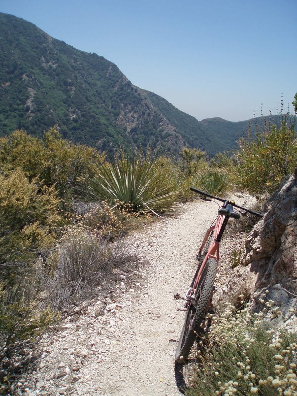
so i visited my brother in/near pasadena. we drove. it was madness. i tried to hook up with clarke. it didn't happen regretably. i found a window of time to get out solo. i googled a ride. bro said it was where they go hiking so it was familiar to him. he dropped me off part way up hwy2 from la canada (need a tilde). i knew from the in-nerd-web that the ranger station i needed was 'red box station.' red box? wow. anyways. rode up the mountain. 34x17. got to another ranger station sooner then my intended destination. got a map. decided to enter the trail further down the mountain instead of going all the way up to red box. hit the trail at the switzer picnic area. found signs for the oakdale camp area. rode a bitchin trial to there. took this pic along the way. more...
6 comments:
...and...let me tell you, this trail was fun. lots of dangerous exposure just after the vegitation at the edge of doom. avalanch shit. bench trail. pretty narrow at times. then it dove into a creek bed type area. lots of trees. trail was bench type still on the side of the creek. flowy. curvy. jumpy if you knew the line. all downhill still, since the entrance point at switzer. made it to the oakdale camp area. found an intersection. found a sign for pasadena. followed that. not as sweet of a trail. kinda river bottoms type. overgrown. thorns and poison oak. expected that from the description on the interweb. the trail started crossing the creekbottom over and over. you could always see the exit of the creek on the otherside so i felt pretty good about my wayfinding, until, about the 5th time it crossed i lost it. ended up at the top of a large concrete dam as i wandered down the creek in search of the exit. shit. looked around. figured the trail turned right or left behind me somewhere or i followed the wrong trail from oakdale. pissed off because i had to be only 2-3 miles from the hwy at the bottom of the mountain. decided the best thing was to bale. abort. full turnaround. 7 or so miles back up. 34x17 not so hot. 3 front flats in a row. lots of walking with the bike on shoulder. ran out of water. never was lost. never worried too much, just sucked having to do it. turned a 3.5hr ride into about 7.5. i'm going to post something like this on mtbr and see if someone can set me straight on the directions. i'd love to do this loop from the brother's house next time i'm out there. and there's other trails in the area. this ride looked like about 1/4 of the total available length.
ADVENTURE!!!
Gotta love it.
Even with the flats and wrong turns the write up sounded like you sure had fun.
That sounds like my kind of fun. Well, sort of.
YES! Stoked you got to ride that trail MW, it is one of my favorite SoCal rides.
I giggled when said "exposure", how else could it be described...maybe "cliffey"?
Fun stuff
hey mod, you remember the end of that thing? it eluded me as you can tell from my ranting.
I don't think I ever really found the "right" way out. After each "fire/flood" season the bottom changes to much I think. You just gotta ride out the creek bed.
We usually stayed up higher on the fireroads and singletrack. I'll have to pull out my San Gabriel Range trail map.
Post a Comment